 Whiteface is the fifth highest of the 46ers at an elevation of 4,867' and was where the 1980 winter Olympics were held. The front side (east) of the mountain is a ski hill and tourists can drive up a toll road almost to the top and then take the stairs or get this an elevator the last 300 feet to the top of the mountain. Or you can hike it from the back side and enjoy the great rugged topography, crossing streams, maneuvering through creek beds and climbing hand over hand up steep rock face hills and peering over ridged cliff edges. Regardless of which way you choose the view from the summit is great (well the weather that day did not offer as great of views as I was hoping for it still was impressive to see the stone fortress like weather station at the top. Apparently this is the only peak in the Adirondacks where distinct evidence of alpine glaciers can be found.


Start of Hike
We parked near Connery Pond and started hiking from there. Total hike from here is about 6 miles with ascends of 3,232 feet. The first portion 2-3miles is rather flat. With the amount of rain the ADK had seen the past week, it was wet and muddy and I was thankful to have remembered my gaiters. At about 3miles in you have to cross a rather deep and wide creek. However, thankful to the hikers ahead of us who built a dam like bridge to cross we managed to hike across without being wet. We met a few hikers that had to wade across unaware of this bridge that was upstream a bit. After crossing the creek you will find a lean-to a few meters ahead - a great place to set up for the night. We met the guys who built the bridge and were able to thank them.
Once past the lean-to the trail begins to get narrower and steeper. Again noting the amount of rain that area received there was lots of runoff coming down the mountain making those steep rock slab portions of the climb slippery and difficult (more so on the descent).


Summit
Once above tree line you are not far from the peak. We decided we’d ditch our poles and packs to make the ascent lighter. The peak which would offer stunning views on a clear day was cloud and mist covered with a piercing cold wind. There was ice on the tops of the pine trees and ice and snow covering the weather station. Although we missed out on seeing the fall colors in the mountain ranges (we will be back again) the weather at the peak instilled a real mountain-like experience. If it was not for the tourists in there clean clothing, dress shoes, perfect hair and make-up the weather and atmosphere would make you feel as if you were 5,000’ higher and isolated.
 Beautiful view of Autumn foliage
 Sitting at False Summit to enjoy some much needed hot coffee


 More views from the False Summit
After taking some photos we descended to a false peak just above tree line. Here we were below the clouds and could see some of the lakes around Lake Placid, and the red and yellow hues of the autumn leaves. The wind still being wickedly cold we hid behind a rock and ate our lunch – coffee, pita, hummus, Kielbasa, and cheese. Once fuelled up we started our descent back the car. We then hit the brew pub in Lake Placid (http://www.ubuale.com/) to pick up a jug of Ubu Ale and then headed back to the cabin for a hot shower and dinner. Dinner was vegetarian lasagna, beef pasta, garlic bread, Caesar salad and red wine. We then hung out by a cozy fire with friends. These friends hiked Giant that day and had a completely different weather experience – one of sun and great views. It goes to show you that you have to be ready for any type of weather in the Adirondacks.


Binoculars
(on a clear day it offers great views of the high peak mountain ranges)
 Weather Station at Summit
The following day our friends decided to do a short hike in South Meadows, however because my Achilles was a bit tender Marc and I decided to head to Lake Placid to check out the Big Mountain Deli that our friends had introduced us to. This gourmet deli offers up a menu of 46 sandwiches named after the 46ers. As a group we decided that it would be fun to enjoy a 46er sandwich after summiting a 46er. We were definitely on board with that idea. Having summated Whiteface, we thought perhaps we’d have Whiteface sandwich, but we have also summated 19 other peaks before Whiteface and therefore decided to pick one of those. I had the Mount Marcy (Roast turkey, cranberry horseradish sauce, cheddar, apple on Whole wheat) and Marc enjoyed the Algonquin (Roast turkey, apple wood smoked bacon, avocado, sprouts and Russian dressing on seeded Rye Bread). Check out this link for photos of our 46er Sandwiches.
Summary
Start: Connery Pond off route 73
Height: 4,868’
Total Distance: 12miles or 20km
Total Hiking Time: 6hours (total hours 7hrs)


 Before the hike enjoyed a cup of coffee with cinnamon raisin breakfast pita (also have muesli ones that are delicious) with PB and banana. Packed full of energy to start off the hike.
  Stopped for a nectarine and almonds snack en route.
 View of the peak of Mt. Colden from the trail.


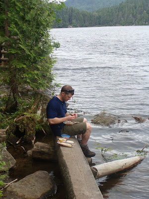 Sitting by Avalanche Lake for lunch - hummus, tortillas, kelbasa, cheese & apples.

 Took the trail around Avalanche Lake on the way down. Very scenic, with lots of ladders, bridges (hitched up matildas) and hand over hand scambling to get around the lake.